

Project Timeline

Vancouver’s Overarching Land Use Strategy
Want to stay updated?
The City of Vancouver is currently taking feedback for the new Rupert and Renfrew Station Area Plan. This is your chance to change the designation for your property and potentially get more density from the city to increase your land value.
Three ways to increase the density for your property:

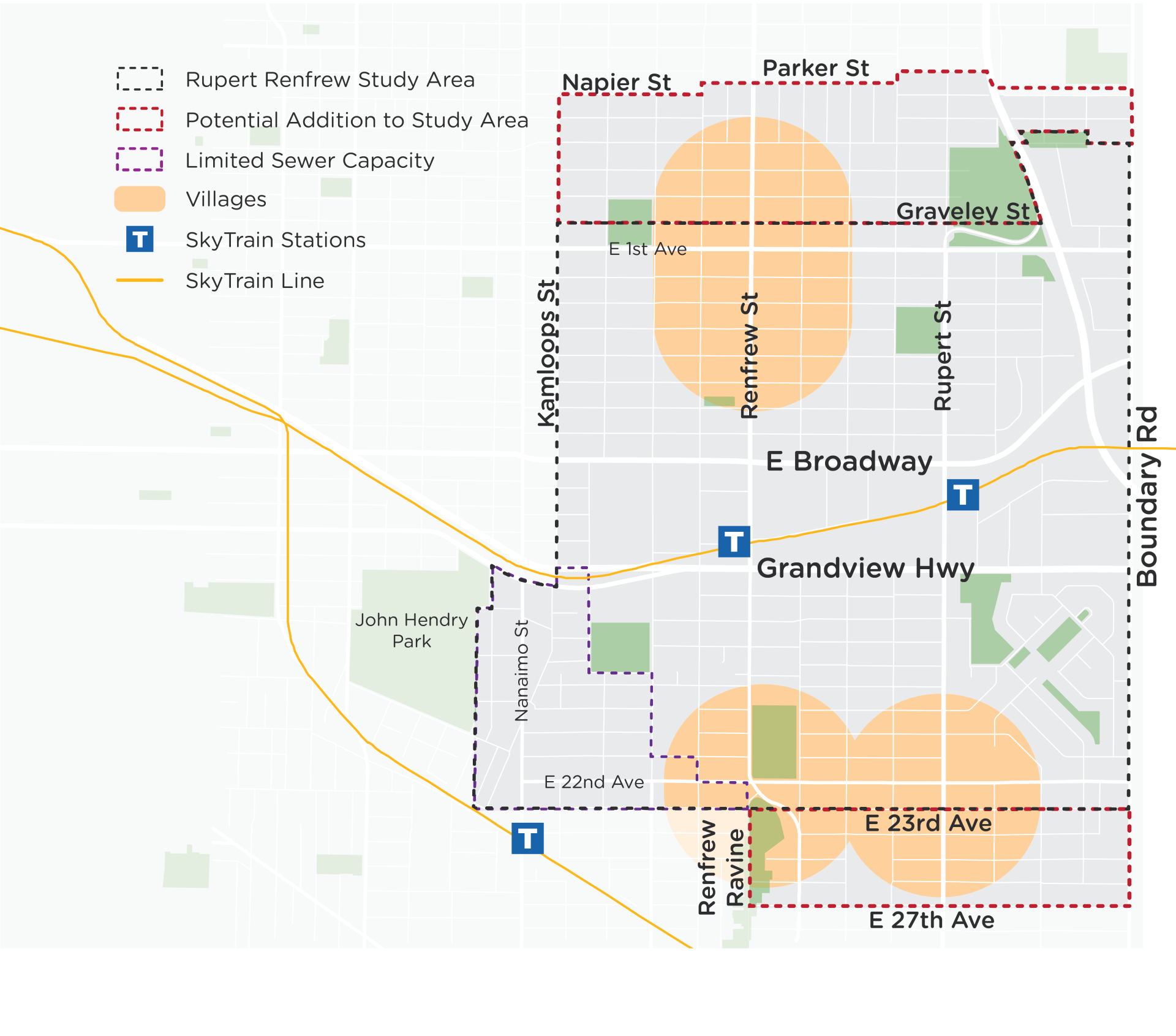
Back in February, City Staff shared an intent to update the study area boundary for the Rupert and Renfrew Station Area Plan.
Now, the following image shows the current updated boundary of the Rupert and Renfrew Station Area.

The area was updated based on these two considerations:

Personal Real Estate Corporation
Team Principal
(604) 349-1571
brandon@apartmentblocks.ca
Brandon Harding is the authority on Land Assembly, a published writer, and a community leader for changing land use in updating Official Community Plans. He is a second generation realtor that has personally transacted over $1,000,000,000+ in sales. Organizing and transacting land has been his passion since listening and learning about the positive impact that can result from successful assemblies through his father, who has been a Commercial Realtor since 1980. Brandon successfully transacted the largest high density land assembly by number of homes.
Brandon has developed the homeowner eligibility test and the PROACTIVE sales funnel, which has revolutionized land assembly and simplified the process for property owners while systematically achieving unmatched results.
Brandon is a thought leader in Commercial Real Estate. Some of his work is published on RENX, LandlordBC, and the Western Investor.
Brandon’s a community coordinator helping homeowners organize, strategize, and deliver a unified voice to Mayors, Councilors, and planning departments. This has led to thousands of property owners achieving higher designations for their properties and making them millions in increased land value. He has the experience and knowledge to empower real change that leads to life changing benefits.